
Fitchburg Neighbor Record Layers
Different records answer different questions about a block. Dane County's map defines adjacent land. Its parcel roll identifies recorded owners, subject to publication opt-outs. Deeds show ownership changes, while association contacts describe a civic area rather than household membership. Keep the purpose narrow before opening a source.
| Source | What It Shows About a Block | Access |
|---|---|---|
| DCiMap parcels | Adjacent parcel shapes, PINs, streets, and aerial context | Free map with Identify and parcel links |
| AccessDane | Owner, billing and situs addresses, legal description, and tax data | Free; owner publication has opt-outs |
| Dane deed index | Recorded ownership changes and land descriptions | Online from 1975; office, mail, Tapestry, or Laredo |
| Plat or CSM | Lots, blocks, outlots, condominiums, and parcel splits | Register of Deeds and parcel links |
| Neighborhood map | Named civic areas and contacts | City list, with an outdated-page warning |
| Historic reverse directory | Selected former occupants or firms by address | Library, archives, and scans; years vary |
An owner name is evidence of title, not proof of residence. A different tax-mail address may be a useful lead, but it can belong to an agent or other recipient. Condominium and apartment parcels also require care because one mapped polygon may not equal one household.
Map Fitchburg Neighbors Outward
The sound block method starts from one known address and expands only as far as the map supports. Dane County DCiMap offers tax parcels, streets, aerial images, soils, elevation, parks, and environmental layers. It does not promise a ready-made radius list. Use map browsing and Identify when no buffer control appears.
- Find the target address in AccessDane, then copy its PIN and legal description.
- Open DCiMap, search or pan to the parcel, and turn on tax parcels and streets.
- Use Identify on the target polygon, then click each adjoining parcel or label.
- Record each PIN and situs address, then follow the parcel link to AccessDane.
- Stop at a sensible edge such as an alley, railroad, creek, arterial road, or subdivision line.
For a complete named-road search beyond the immediate block, use the Fitchburg street directory. That broader workflow walks addresses along the street, while this one stays focused on parcels that share the local space.
Read Fitchburg Parcel Cards
The AccessDane property portal accepts owner, address, or parcel searches. Its advanced tabs add municipality, township and range, section, plat, certified survey map, lot, block, building, and unit. Choosing Fitchburg as the municipality helps avoid similarly named streets elsewhere in Dane County.
A parcel card can show municipality, PIN, legal description, owner subject to opt-out, situs and billing addresses, land and improvement values, taxes, assessment year, districts, classification, document links, and a map link. Values are assessments, not sale prices. Dane County says about 97 percent of owner information is published, so a blank owner field does not mean land has no owner.
The successful manifest image shows the AccessDane advanced parcel search used to narrow nearby Fitchburg lots.
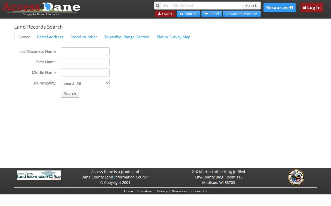
Plat and survey fields are especially useful when a block contains condominiums, outlots, or lots that do not line up neatly with street numbers.
Define a Fitchburg Block
Physical closeness and legal adjacency are not the same. A home across a creek may look near on an aerial image but sit outside the target plat or neighborhood. Parcel polygons provide the legal land shape. Street, water, wetland, zoning, and aerial layers help explain why a block bends or stops.
- Parcel
- A mapped unit of land identified by a parcel identification number.
- PIN
- The parcel identification number used to connect map, tax, and deed records.
- Plat
- A recorded map that lays out a subdivision, lots, blocks, and related land.
- CSM
- A certified survey map used for surveyed parcels and land divisions.
- Situs address
- The physical property address, which may differ from the billing or postal address.
Fitchburg combines dense subdivisions, apartment parcels, long-established homes, and rural land. One rule cannot define every block. State the edge used and preserve the map date if the result will be shared.
Fitchburg Neighborhood Contacts
The city's association page identifies 26 named areas, but it is marked as no longer updated. The map includes Belmar, Briarwood, Byrnewood, Chapel Valley, Country Heights, Country Vineyard, East Fitchburg, Greenfield, Harlan Hills, Highlands of Seminole, Hillside Heights, Jamestown, Lacy Heights, Leopold, Northeast Fitchburg, Oak Meadow, Pine Ridge, Quarry Hill, Renaissance on the Park, Seminole Forest, Seminole Hills Estates, Seminole Ridge, Swan Creek of Nine Springs, Western Hills, Wildwood, and Wildwood South.
| Local Resource | Best Use | Important Limit |
|---|---|---|
| City association map | Find a named area and supplied contact | Page is stale and not all groups appear |
| City contact PDF | Distinguish formal groups from informal contacts | No complete public member directory was found |
| Recorded HOA restrictions | Read private rules tied to land | Restrictions do not identify current members or occupants |
A line on the city map does not prove a household belongs to an association. Boundaries can change, some members live beyond a subdivision name, and other groups may exist. Ask the contact how residents join and whether any newsletter or directory is public.
Plats Frame Fitchburg Neighbors
Subdivision and condominium plats form the block's legal skeleton. They can show lots, blocks, outlots, roads, easements, buildings, and units. AccessDane's advanced search supports plat name, certified survey map number, block, lot, outlot, building, and unit. Recorded plats and survey maps are also part of the Dane County Register of Deeds collection.
A plat may explain why one tax parcel covers shared land or why several units use one street address. Deed restrictions can establish an HOA or private rules, but they are not a list of Fitchburg neighbors. If the online link is missing or the scan is unclear, request the recorded document by number from the Register of Deeds, visit for free viewing, or order a copy by mail.
Nearby Fitchburg Voter Records
Wisconsin law makes the official registration list public by name and address, but it restricts birth dates, driver-license numbers, Social Security numbers, confidential-elector addresses, and accommodation indicators. A full electronic voter file is a separate fee-based route. MyVote is designed for a voter to confirm their own registration with first name, last name, and date of birth. No general street-browse feature was found there.
Do not infer household size from voter names. A block can include owners who are not registered there, registered renters, several registered adults, people too young to register, and confidential electors whose actual addresses are withheld. Safe at Home participants may use a substitute address and confidential voter status under Wisconsin law.
Verify Fitchburg Neighbor Claims
Commercial neighbor tools often combine telephone, marketing, parcel, and purchased fragments. Their maps may be quick, but they can join an old name to a current parcel or confuse an owner with an occupant. Official rolls also have limits, yet each field has a named custodian and a clear meaning.
| Question | Official Record Route | Commercial Compilation Risk |
|---|---|---|
| Which land touches? | DCiMap parcel geometry | Radius may cross roads, water, or plat lines |
| Who owns it? | AccessDane plus deed index | Old owner may remain attached |
| Who lives there? | No complete official household roster | Owner, phone, and marketing names may be merged |
| Which civic group serves it? | City map and direct association contact | Boundary or membership may be assumed |
Use the map to define the place, the parcel card to identify title data, and the deed image when the ownership claim matters. Contact a person directly and respectfully instead of treating a compiled name as fact.
Historic Fitchburg Neighbors
For an earlier block, Madison's reverse directories can place selected people and firms at street numbers. Coverage must be checked in each edition because no separate Fitchburg city-directory run was found, and rural addresses may be absent. The Fitchburg Historical Society's 1958 Dane County Plat Book and Rural Directory is a stronger bridge for farm-era households.
Historic place names matter too. Search Greenfield for records before the 1853 rename, plus Town of Fitchburg, Oak Hall, Syene, Swan Creek, Lake View, Stoner's Prairie, and Dogtown. The 2022 Town of Madison attachment changed civic administration without requiring a universal mailing-address change. A Madison postal label therefore does not settle which city governs a parcel.
Protect Fitchburg Neighbor Privacy
Parcel records do not list all occupants. Utility customer names and DMV address files are not public block directories. AccessDane allows owner-name publication opt-outs, and Safe at Home can protect an actual address. Military discharges and some recorded material have separate restrictions. If a source hides a field, do not try to defeat that safeguard through another person's account or private data.
Public information should serve a limited, lawful aim such as understanding a plat, contacting an association, researching local history, or confirming the owner of land involved in a personal transaction. A current record can still be incomplete or wrong. Check it with the custodian and give living people room to correct a mistake.
Lawful use. Learn about a Fitchburg block with care. Never use neighbor records to watch, harass, intimidate, or harm anyone.